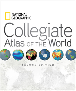
National Geographic Collegiate Atlas of the World, Second Edition
Select Format
Select Condition 
Book Overview
Two opening spreads in the front matter help the reader to better interpret images and new data. "Remote World" introduces readers to data collection via remote sensing and GPS technology. "Understanding Our World Spatially" follows, covering data processing and analysis as it relates to mapping and using GIS technology (Geographic Information Systems). These explanatory introductory pieces provide the foundation for students to gain insight into modern-day map making, which is reflected in the content of the colorful, engaging, fact-filled spreads that lie ahead. The atlas also addresses the traditional subjects of map scales, projections, and map reading skills. Based on feedback from more than 100 professors, educational reviewers, and other consultants, we have added special thematic map spreads addressing each Continental Economy. In addition--within each continent--physical, political, and regional mapping is presented at the same scale, which allows the reader to compare map information easily and accurately. This feature of a fixed scale for regions provides the reader the option to roam from one end of a continent to its other end, flipping through the pages, while maintaining a constant scale. The atlas is organized as follows:
The Front matter with its new spreads on data collection and then data processing.
The World: with 25 spreads on Natural and Human themes including: Tectonics, the Biosphere, World Energy, World Health, Nutrition, and Literacy, and Technology and Globilization.
The atlas then zooms into Continental coverage:
Like the world thematic section, each of these continental parts will cover many important natural and human themes such as climate, natural hazards, income/GDP, and Trade. In addition, core political, regional coverage completes each continent's signature of human boundaries and places.
The fascinating polar regions and the vast world oceans come next.
Finally, abundant, clear, and precise appendices provide an invaluable back matter, reference section. A 105-page, place-name index is included as well. Careful selection of place-names and features make the maps very informative but not overly cluttered. Computer-generated shading enhances the look of the political maps while providing valuable information on topography. The ocean floors of the world are dramatically portrayed with bathymetric relief paintings. And lastly, world political information, statistics, geographic comparisons, and glossaries are organized in easy-to-use sections in the back matter--all of this in a manageable, easy-to-handle, value-packed, 400-page, 9 x 11 format.
Format:Hardcover
Language:English
ISBN:1426208391
ISBN13:9781426208393
Release Date:August 2011
Publisher:National Geographic Society
Length:400 Pages
Weight:3.65 lbs.
Dimensions:1.2" x 9.4" x 11.2"
Customer Reviews
3 ratings
Good Atlas...
Published by Thriftbooks.com User , 16 years ago
I wanted one Good Atlas for my Library and everyday use. I am very Happy with this Atlas.
A more wieldy version of the NG atlas
Published by Thriftbooks.com User , 16 years ago
I own quite a few atlases, but my favorite has always been the National Geographic Atlas. I find the cartography in it strikes the best balance between information and esthetics. But if I'm reading a book and want to quickly look a place up, the NG atlas is too unwieldy. The NG Collegiate Atlas is a more convenient size for keeping by your reading chair and grabbing for a quick look-up, rather than finding a table to open up the big atlas. The Collegiate Atlas has the same quality of maps, plus many pages of thematic maps not found in the big atlas. Besides being handy for quick reference, it is a pleasure to browse through. The biggest drawback at first was, as other reviewers have mentioned, the apparent lack of sufficient gutter space; the binding swallows up much of the printing. But in fact the book has been well designed and the gutter space is there; you just have to spend some time breaking in the binding. I spent about a half-hour paging through the book, forcing open the binding on every double spread. (It often required opening the book so wide that the front and back covers touched. This idea may horrify you, but the binding can take it.) Once I've accomplished this all the maps were fully readable. If you're willing to put in the effort, you'll be rewarded with an informative and beautiful atlas that is also easy to handle. If not, you'd be better off with Goode's Atlas.
National Geographic Collegiate Atlas of the World
Published by Thriftbooks.com User , 18 years ago
I found this Atlas very useful. When I research world events and specific areas that things are occurring in this atlas comes in handy. It is easy to use and the maps, graphs and other pertinent statistics are very readable. For quick reference I recommend this atlas.


